
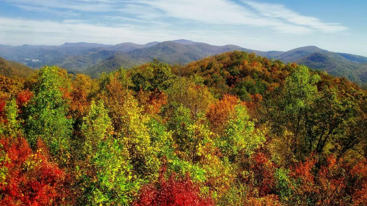
Wondering how the regions of Georgia fit together? Think of four: the northern mountains, the Piedmont, and the Upper and Lower Coastal Plain, drawn from five physiographic provinces. Here is what defines each.
More civic and regional explainers sit in the georgia news section.
| Item | Value |
|---|---|
| Physiographic provinces in Georgia | 5 |
| North-to-south extent | About 300 miles |
| Elevation range | Sea level to more than 4,700 feet |
| Highest point (Brasstown Bald) | 4,784 feet above sea level |
| First U.S. gold rush at Dahlonega | 1828 |
| Parts of the Coastal Plain | 2 (Upper and Lower) |
These figures come from the New Georgia Encyclopedia geographic regions overview, last edited in July 2018. Figures can change, so check the source before you rely on them.
How the regions of Georgia are counted
The New Georgia Encyclopedia says Georgia encompasses parts of five physiographic provinces, as the geographic regions overview explains. They are:
- the Appalachian Plateau
- the Valley and Ridge
- the Blue Ridge
- the Piedmont
- the Coastal Plain
This guide folds the first three into one northern group and splits the Coastal Plain into its upper and lower halves. That gives four working regions that are easier to hold in your head. It is an editorial grouping for readability, not an official boundary.
Georgia is the largest U.S. state east of the Mississippi River, yet it covers only about 300 miles from north to south. Even so, elevations run from sea level to more than 4,700 feet, which is why the landscape changes so much over a short distance.
Region one: the northern mountains and valleys
The northern group holds three provinces that share a mountainous, rocky character:
- The Appalachian Plateau, including Lookout Mountain, sits in the extreme northwestern corner.
- The Ridge and Valley runs northeast to southwest, with parallel ridges and valleys. It has historically been a mining area, with some farming on the valley floors.
- The Blue Ridge is the southern end of the Appalachian mountain range in Georgia.
The state’s highest points are in the Blue Ridge, including Brasstown Bald at 4,784 feet above sea level. The same area saw the first U.S. gold rush at Dahlonega in 1828, according to the encyclopedia overview. Today its mountain streams and cool summer breezes make it primarily a place for recreation.
Region two: the Piedmont, where most Georgians live
The Piedmont is a belt of mountain foothills that is home to most of Georgia’s population. According to the overview, most of the state’s cities are here, and the area is highly industrialized. Its industries include carpet milling, aircraft and automobile manufacturing, and poultry processing.
The Piedmont once served as the primary area for growing cotton. Agriculture is still significant, but animal products such as poultry, eggs and beef now dominate.
The region’s famous red clay has a name: saprolite, a thick layer of decomposed rock that overlies much of the Piedmont, as the Piedmont entry notes. It erodes easily once the forest is cleared, which is why early cotton and tobacco fields were sometimes abandoned after only a few years.
The fall line: where the Piedmont meets the south
The fall line is the geologic boundary between the Piedmont and the Coastal Plain. Rivers that cross it produce waterfalls, and the encyclopedia traces the line from Augusta on the Savannah River, through Milledgeville, Macon and Columbus:
- Augusta, on the Savannah River at the South Carolina border
- Milledgeville, on the Oconee River
- Macon, on the Ocmulgee River
- Columbus, on the Chattahoochee River at the Alabama border
Cities grew up at these falls as points where cargo moved from riverboats and barges to trains and wagons, per the geographic regions overview. The Piedmont entry names Augusta, Macon and Columbus as the important fall line cities.
The southern regions: the Upper and Lower Coastal Plain
South of the fall line lies the Atlantic Coastal Plain, which has two parts: the Upper and the Lower Coastal Plain. The overview describes them differently.
- Upper Coastal Plain: It covers the central and southwestern portions of the state, and agriculture is the dominant activity. The core of the state’s peanut, cotton and vegetable industry is here.
- Lower Coastal Plain: It includes the actual coastal area, the Sea Islands and the Okefenokee Swamp. Some farming occurs, but the area is significant for shipping and recreation tied to the Georgia coast.
The Piedmont entry adds that the Piedmont lies between the Blue Ridge Mountains and the Upper Coastal Plain, which shows how the regions stack from north to south.
Water, weather and the regions
Geology at the fall line also splits Georgia’s water supply. The northern part depends almost exclusively on surface water because of the underlying granitic rock, while the southern part has excellent aquifers and uses primarily groundwater.
Because the entire metropolitan Atlanta area sits in the Piedmont, surface water must supply most of the state’s needs, according to the encyclopedia overview.
Readers curious about how weather differs from mountains to coast can read the georgia climate overview. For a lighter look at the state, the georgia state symbols page is a good next stop.
Frequently asked questions
How many regions does Georgia have?
Show answer
The New Georgia Encyclopedia counts five physiographic provinces, on a page last edited in July 2018 (source). This guide groups them into four for easier reading.
Which region has most of Georgia’s people?
Show answer
The Piedmont. The encyclopedia says it is home to most of the state’s population, including the entire metropolitan Atlanta area.
What is the fall line?
Show answer
It is the geologic boundary between the Piedmont and the Coastal Plain, where rivers produce waterfalls.
Where is Georgia’s highest point?
Show answer
Brasstown Bald, at 4,784 feet above sea level, is in the Blue Ridge, according to the overview.